|
|

|
|
|
| About the Weather Station.. |
 |
|
Station Type: Davis Vantage Pro 2 (wind, rain, temperature, and humidity) with wireless link to a USB Davis Envoy receiver.
(View Weather Station Status Log)
|
| Situation: The weather station is situated at the end of a wooden landing stage ("jetty") which extends south-southeast into the River Itchen on the same bank as, and about 80m east from, the Priory Road Public Hard. |
| Position: 50° 55.24'N 1° 23.17'W |
Post Code: SO17 2HS |
|
|
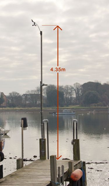
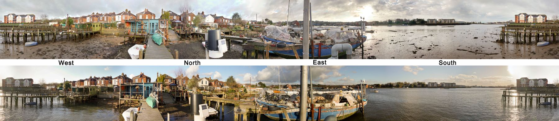
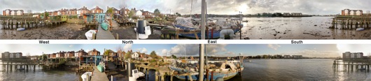
Anemometer Exposure: The anemometer is on a pole 4.35m above the jetty decking which itself is about 4.8m above chart datum. This implies an anemometer height which varies between about 7.2m above the mud at low tide and about 4.4m above water at the highest spring tides (the maximum tidal range is about 5m). The fetch (see panorama below) varies from about 0.6km to the SSW to 0.24km to the south, but is restricted to the north by houses, the closest being about 30m away. The roof of the blue windowed shed at the shore end of the jetty is about 2m below the anemometer height. The fetch to the east is about 0.4km but there are many obstructions.
|
 |
360° Panorama: These photos show the tide out and most of the way in. The central post bisecting the photos is the anemometer pole.
 [click to enlarge and zoom and pan the popup window as required]
 |
|
[Values in the top banner are updated every 10 minutes, refresh your browser to see the latest] |

|
| Powered by WeatherCat
|
|